Electrical Commissioning In Industrial Power Systems
Our customized live online or in‑person group training can be delivered to your staff at your location.

- Live Online
- 12 hours Instructor-led
- Group Training Available
Regular Price:
$599
Coupon Price:
$499
CALGARY
—
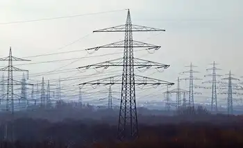
Calgary Winter Storm and Extreme Cold delivers heavy snowfall, ECCC warnings, blowing snow, icy roads, and dangerous wind chill across southern Alberta, as a low-pressure system and northerly inflow fuel hazardous travel and frostbite risks.
What's Behind the News
A severe Alberta storm with heavy snow, strong winds, ECCC warnings, dangerous wind chill, and high frostbite risk.
ECCC expanded snowfall and winter storm warnings regionwide.
Calgary recorded 4 cm Jan 16, with more expected Jan 17.
Travel advised against amid icy, snow-packed roads and low vis.
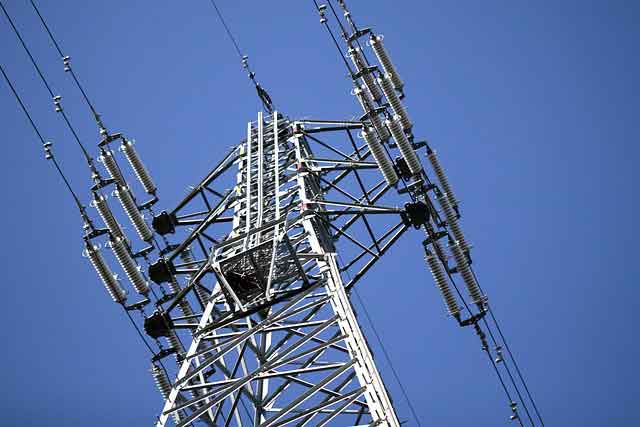
Frostbite risk at -28 to -47 wind chills; power demand surged.
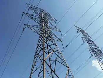
Calgary and much of southern Alberta faced a significant winter storm that brought heavy snowfall, strong winds, and dangerously low temperatures. Environment and Climate Change Canada (ECCC) issued extended and expanded snowfall and winter storm warnings as persistent precipitation streamed along the southern borders. The combination of a low-pressure system off the West Coast, where a B.C. 'bomb cyclone' had left tens of thousands without power, and a northerly inflow at the surface led to significant snow accumulations in a short period.
The storm resulted in poor driving conditions across much of southern Alberta, with snow-packed and icy roads, as well as limited visibility due to blowing snow. ECCC advised postponing non-essential travel until conditions improved. As of 10 a.m. on January 17, the 511 Alberta map showed poor driving conditions throughout the region, while B.C. electricity demand hit an all-time high amid the cold.
In Calgary, the city recorded four centimeters of snow on January 16, with an additional four centimeters expected on January 17. Temperatures remained far below seasonal averages until the end of the week, and Calgary electricity use tends to surge during such cold snaps according to Enmax, with improvements starting on Sunday.
The extreme cold posed significant risks, with wind chills of -28 to -39 capable of causing frostbite in 10 to 30 minutes, as a Quebec power demand record illustrated during the deep freeze. When wind chills dropped to -40 to -47, frostbite could occur in as little as five to 10 minutes. Residents were advised to watch for signs of frostbite, including color changes on fingers and toes, pain, numbness, tingling sensations, or swelling. Those most at risk included young children, older adults, people with chronic illnesses, individuals working or exercising outdoors, and those without proper shelter.
In response to the severe weather, the Alberta Motor Association (AMA) experienced a surge in calls for roadside assistance. Between January 12 and 14, there were approximately 32,000 calls, with about 22,000 of those requiring rescues between January 12 and 14. The high volume of requests led the AMA to temporarily cease providing wait time updates on their website due to the inability to provide accurate information, while debates over Alberta electricity prices also intensified during the cold.
The storm also had broader implications across Canada. Heavy snow was expected to fall across wide swaths of southern British Columbia and parts of southern Alberta, as BC Hydro's winter payment plan offered billing relief to customers during the stretch. Northern Alberta was under extreme cold warnings, with temperatures expected to dip to -40°C through the rest of the week. Similar extreme cold was forecast for southern Ontario, with wind chill values reaching -30°C.
As the storm progressed, conditions began to improve. The wind warning for central Alberta ended by January 17, though a blowing snow advisory remained in effect for the southeast corner of the province. Northwest winds gusting up to 90 km/h combined with falling snow continued to cause poor visibility in some areas, while California power outages and landslides were reported amid concurrent severe storms along the coast. Conditions were expected to improve by mid-morning.
In the aftermath of the storm, residents were reminded of the importance of preparedness and caution during severe winter weather. Staying informed through official weather advisories, adjusting travel plans, and taking necessary precautions can help mitigate the risks associated with such extreme conditions.
Related News
Related News
DOE Announces $34 Million to Improve America?s Power Grid
DOE GOPHURRS Grid Undergrounding accelerates ARPA-E innovations to modernize the power grid, boosting reliability, resilience,…
View more
Energy-insecure households in the U.S. pay 27% more for electricity than others
Community Solar for Low-Income Homes expands energy equity by delivering renewable energy access, predictable bill…
View more
B.C. ordered to pay $10M for denying Squamish power project
Greengen Misfeasance Ruling details a B.C. Supreme Court decision awarding $10.125 million over wrongfully denied…
View more
Surging electricity demand is putting power systems under strain around the world
Global Electricity Demand Surge strains power markets, fuels price volatility, and boosts coal and gas…
View more

N.S. approves new attempt to harness Bay of Fundy's powerful tides
Bay of Fundy Tidal Energy advances as Nova Scotia permits Jupiter Hydro to test floating…
View more

Notley announces plans to move Alberta's electricity grid to net-zero by 2035 if elected
Alberta NDP Net-Zero Electricity Plan targets a 2035 clean grid, expands renewable energy, cuts emissions,…
View more
Sign Up for Electricity Forum’s Newsletter
Stay informed with our FREE Newsletter — get the latest news, breakthrough technologies, and expert insights, delivered straight to your inbox.
Electricity Today T&D Magazine Subscribe for FREE
Stay informed with the latest T&D policies and technologies.
- Timely insights from industry experts
- Practical solutions T&D engineers
- Free access to every issue
