CSA Z462 Arc Flash Training – Electrical Safety Compliance Course
Our customized live online or in‑person group training can be delivered to your staff at your location.

- Live Online
- 6 hours Instructor-led
- Group Training Available
Regular Price:
$249
Coupon Price:
$199
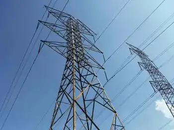
A county commissioner in West Virginia says final site maps for Virginia's first wind-powered electric generation project are wrong.
Pocahontas County Commission President Martin Saffer says the state boundary shown on Highland New Wind Development's maps don't match U.S. Geological Survey maps.
Based on the geological maps, Saffer says Highland is planning to build one, perhaps two of its 19 wind turbines in West Virginia.
If that's true, he says Highland needs approval from West Virginia regulatory agencies.
Highland says it used GPS technology to chart the Allegheny Mountain crest that divides the two states.
Work began earlier this month on the $60 million wind farm capable of producing 38 megawatts of electricity.
Related News
Building begins on facility linking Canada hydropower to NYC
Champlain Hudson Power Express Converter Station brings Canadian hydropower via HVDC to Queens, converting 1,250…
View more

Electricity turns garbage into graphene
Waste-to-Graphene uses flash joule heating to convert carbon-rich trash into turbostratic graphene for composites, asphalt,…
View more

China boosts wind energy, photovoltaic and concentrated solar power
China Renewable Energy Law drives growth in wind power, solar thermal, and photovoltaic capacity, supporting…
View more

Hydro One will keep running its U.S. coal plant indefinitely, it tells American regulators
Hydro One-Avista Merger outlines a utility acquisition shaped by Washington regulators, Colstrip coal plant depreciation,…
View more
UAE’s nuclear power plant connects to the national grid in a major regional milestone
UAE Barakah Nuclear Plant connects Unit 1 to the grid, supplying clean electricity, nuclear baseload…
View more

Sask. sets new record for power demand
SaskPower Summer Power Demand Record hits 3,520 MW as heat waves drive electricity consumption; grid…
View more
Sign Up for Electricity Forum’s Newsletter
Stay informed with our FREE Newsletter — get the latest news, breakthrough technologies, and expert insights, delivered straight to your inbox.
Electricity Today T&D Magazine Subscribe for FREE
Stay informed with the latest T&D policies and technologies.
- Timely insights from industry experts
- Practical solutions T&D engineers
- Free access to every issue
