Substation Relay Protection Training
Our customized live online or in‑person group training can be delivered to your staff at your location.
- Live Online
- 12 hours Instructor-led
- Group Training Available
Regular Price:
$699
Coupon Price:
$599
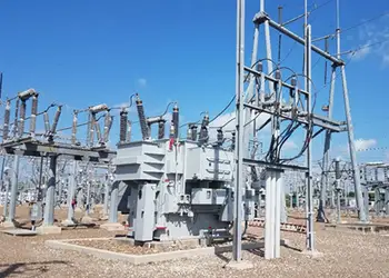
Smart Grid GIS helps utilities align with the DOE report, using ESRI's benchmark study to assess smart grid readiness, data management, geospatial analysis, network planning, mobile applications, visualization, communications, and reliability across transmission and distribution.
Main Details
Smart Grid GIS modernizes utility networks with geospatial analytics for benchmarking, planning, and reliable service.
- ESRI benchmark compares smart grid readiness among peers
- Guides utilities on data management and geospatial workflows
- Supports planning for transmission and distribution assets
- Enables mobile field apps, visualization, and situational awareness
- Integrates communications and electric networks for reliability
The U.S. electric system, "the supreme engineering achievement of the 20th century," is aging, inefficient, congested, and incapable of meeting future energy needs, according to a recent U.S. Department of Energy (DOE) report.
As electric utilities work to overcome challenges laid out in the DOE report, they can find guidance in a new benchmark study that focuses on a smart grid trend and geographic information system (GIS) technology. The study, conducted by GIS technology leader ESRI, provides participants with customized reports comparing their smart grid readiness to that of peer groups.
Believed to be the solution to modernize utilities around the world, smart grids proliferating worldwide add communication and computer technology to electric networks, ensuring cleaner, more reliable, and more affordable energy. GIS is the sturdy platform on which utilities rely for crucial smart grid components such as data management, analysis, planning, same wires, more power strategies, mobile applications, visualization, and awareness.
"We want to help utilities assess their own systems and, at the same time, gain insight into what services and products we should provide to meet the industry's changing needs," said Bill Meehan, ESRI's director of utility solutions and author of the study's base survey. "GIS is widely recognized for its strong role in managing traditional electric transmission and distribution, as well as telecommunications networks, supporting a green grid approach across operations today. With smart grid's sophisticated communication network superimposed on the electric network, during the renewables transition, data management with GIS becomes utterly critical."
Participation in the study via online survey is open to all utilities. The names of participants and utilities will remain confidential. Utilities may participate from September 1 through October 31, 2009, at www.esri.com/smartgridsurvey.
Related News
Related News
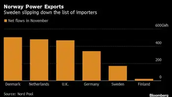
Europe's Thirst for Electricity Spurs Nordic Grid Blockade
Nordic Power Grid Dispute highlights cross-border interconnector congestion, curtailed exports and imports, hydropower priorities, winter…
View more
Tube Strikes Disrupt London Economy
London Tube Strikes Economic Impact highlights transport disruption reducing foot traffic, commuter flows, and tourism,…
View more
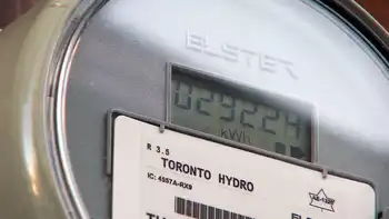
Ontario introduces new 'ultra-low' overnight hydro pricing
Ontario Ultra-Low Overnight Electricity Rates cut costs for shift workers and EV charging, with time-of-use…
View more
Ontario's five largest electricity providers join together to warn of holiday scams
Ontario Electricity Bill Scams: beware phishing, spoofed calls, fake invoices, and disconnection threats demanding prepaid…
View more

Washington State Ferries' Hybrid-Electric Upgrade
Washington State Hybrid-Electric Ferries advance green maritime transit with battery-diesel propulsion, lower emissions, and fleet…
View more
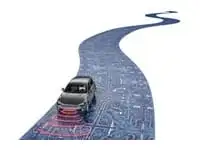
Roads Need More Electricity: They Will Make It Themselves
Electrically Smart Roads integrate solar road surfaces, inductive charging, IoT sensors, AI analytics, and V2X…
View more
Sign Up for Electricity Forum’s Newsletter
Stay informed with our FREE Newsletter — get the latest news, breakthrough technologies, and expert insights, delivered straight to your inbox.
Electricity Today T&D Magazine Subscribe for FREE
Stay informed with the latest T&D policies and technologies.
- Timely insights from industry experts
- Practical solutions T&D engineers
- Free access to every issue
